
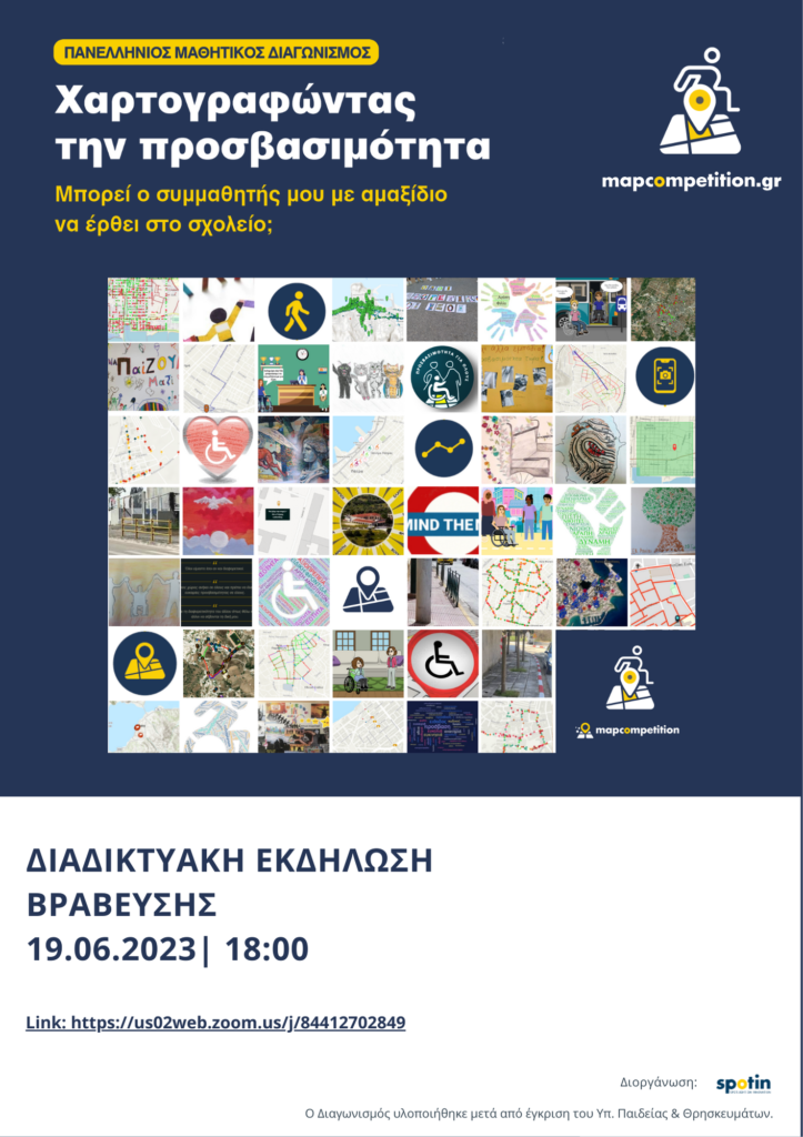
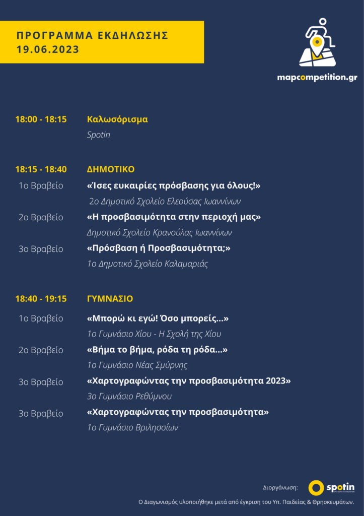
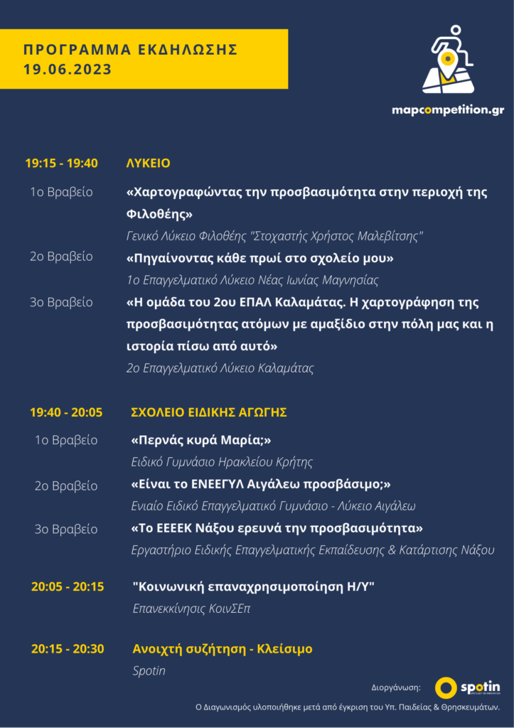
The 2nd Panhellenic School Map Competition, themed “Mapping Accessibility: Can my classmate in a wheelchair reach school?”, officially concluded with its awards ceremony.
Over eight months, students learned to use geotechnologies and create digital maps, acting as “human sensors” by personally collecting accessibility data for their local areas. Most importantly, they raised awareness through exceptional hands-on inclusion activities, inspiring their peers and local communities.
Spotin extends warm thanks to the Ministry of Education, educators, students, the Evaluation Committee, Marathon Data Systems, Koinsep Epanekkinisis, and all those who shared their experiences on disability and accessibility (incl. Makis Kalaras, Cool Crips, Panagiotis Pitsiniagas and AccessLab).
The community continues to grow, with the hope that this Competition helped see the world through “different, more inclusive eyes”.
We are excited for our joint future educational journeys!
Spotin participates as a project partner in the ERASMUS+ project SME-RISE (Business Modelling Skills for Drone Entrepreneurs), which aims to strengthen entrepreneurship in the drone
On Wednesday, March 18, Spotin co-hosted, together with NTUA (coordinator of the GEO-Academy project), the online award ceremony of the European Map Storytelling Competition “GeoVoices: