Welcome to Spotin!
We bring maps, geospatial technologies and digital storytelling to life — designing learning experiences that
connect people to the world around them, spark curiosity and build active, engaged citizens.
JOIN OUR LEARNING COMMUNITY
EXPLORE OUR PROJECTS
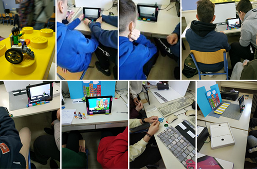
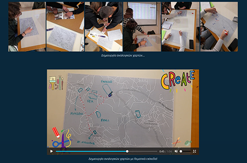
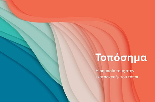
Mapping our local landmarks
4th Panhellenic School Map Competition. Map your living place. Tell its story. Learn with schools across Greece.
LEARN MORE
DIGITAL LIBRARY OF SCHOOL PROJECTS
SUBMIT YOUR PARTICIPATION
Map Competition
Digital Library of School Projects VISIT THE DIGITAL LIBRARY OF SCHOOL PROJECTS
190+ School Projects. One Digital Library. Explore the maps, stories and fieldwork created by students from across Greece.
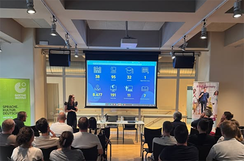
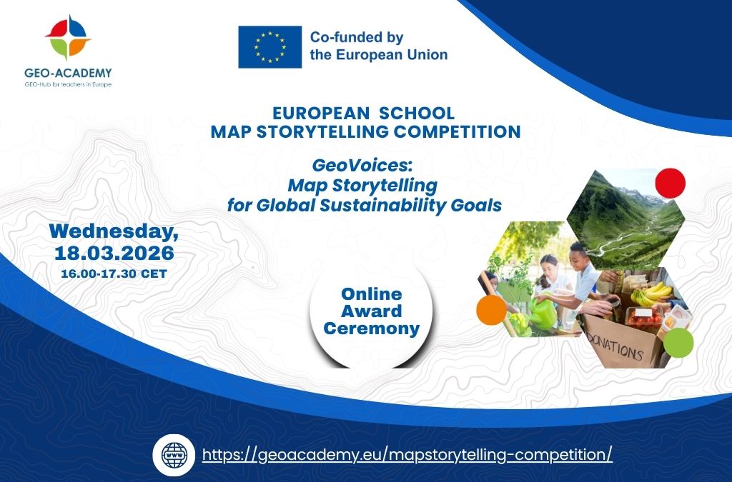
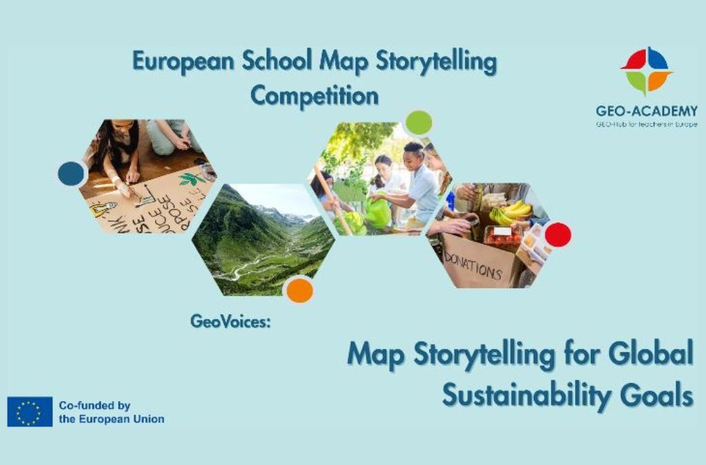
GEO-Academy
An EU-funded project bringing innovative geo-tools into STEAM classrooms — training teachers across Europe in digital, spatial and green skills on sustainable development topics.
Learn More
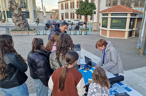
Mapping Cultural Heritage
A digital library of intangible cultural heritage, created in collaboration with Xorostasi —
the Folk Music and Dance Club of Glyfada.
VISIT THE DIGITAL LIBRARY
Who we are
Spotin is a meeting point- where technology and science meet education and society.
We are a growing learning community that brings together students, educators and innovators to explore the world through digital maps, geo-storytelling and geospatial technologies.
Since 2021, we have been designing learning experiences that go beyond the classroom — through the Panhellenic School Map Competition, EU-funded projects, teacher training programmes and openly accessible educational resources.
Through hands-on experiences and collaborative projects, we help people develop curiosity, creativity and critical thinking — shaping more active and engaged citizens.
At Spotin, we don’t just teach tools. We inspire discovery.
We deliver training programmes for educators, students and professionals on GIS, digital maps and geo-storytelling
We develop open-access educational resources designed for real-world use — in classrooms, communities and beyond.
Geo-Technologies & Maps
We specialize in Geographic Information Systems (GIS), digital map-making and geo-storytelling in education
We develop geo-applications
We collaborate with universities and research institutions, implementing EU-funded projects that bring spatial thinking and digital tools into education and society.
Citizens & Society
We design interdisciplinary, project-based learning experiences around real social challenges
Every project activates school communities and local societies, cultivating more curious, spatially literate and engaged citizens.
We build lasting networks of educators, researchers and innovators who share knowledge, tools and inspiration
We make geotechnologies accessible to learners of all ages and backgrounds
We connect learning to real-world challenges through inquiry-based, project-based and experiential approaches
We provide hands-on training and practical open-access tools for educators and organisations
We foster collaboration between schools, communities, researchers and experts
We inspire curiosity, creativity and active citizenship through the power of maps and storytelling
Practice Areas
Environment
Mapping environmental challenges through field-based learning and geo-data.
STE(A)M Education
Connecting science, geography, arts and technology through geospatial tools and and project-based learning.
Cultural Heritage
Exploring and promoting intangible cultural heritage through digital maps and geo-storytelling.
Society & Citizenship
Learning experiences rooted in real social challenges — building spatially literate, active citizens.
Open Innovation
EU-funded projects and geo-applications advancing spatial knowledge in education and society.
Why Spotin?
Environment
STE(A)M Education
Science & Technology
Culture
Society
Sports
Testimonials
“Raising awareness among students about the inclusion of people with disabilities is the foundation for changing the culture of the new generation towards diversity. If you want to change the world, start with children. This specific program constituted the first but most significant step towards awakening the local community and, consequently, the world in general.”
“This journey turned out to be unexpectedly constructive for everyone, both young and old. I believe it changed me as a person! I saw the world through different eyes…”
“It was an incredible experience for both us and our students, who began to activate on raising awareness of people around them about diversity.”
“Organizing a competition on the theme of refugee uprooting, as well as utilizing this software to present the school projects with personal testimonies, was an outstanding initiative. Participating schools presented notable projects and gained many benefits, both the students with their families and the educators.”
“The restructuring of school programs is necessary so as to include such activities within the school hours.”
"Map-making was what first drew me into joining the competition — and brought my school along with me. But in the end, it was the theme that really mattered. Bravo to Spotin, bravo for the choice of topic! I am certain that everyone involved learned something."
"I liked that we had to collaborate. The experience of interviewing people with mobility disabilities helped me better understand the issue and respect those around me more."
"The waterways of Drama are not just geographical features — they are our very identity. Through this storymap we discovered the richness of our natural heritage and understood its importance in every aspect of our lives. As students and future citizens, we commit to respecting and protecting this precious resource."
"The competition gave us the chance to discover how water — as a route, a challenge and a source of inspiration — became the foundation of our island's seafaring tradition. We also learned new digital mapping tools and told our stories in a contemporary way. Through this experience, we didn't just learn about the past — we brought it into the present, through our own eyes."
"Thank you for giving us, through the Map Competition, the opportunity to collaborate, organize activities, get to know the river of our city and discover its importance for all of us."
"Using geo-storytelling, we brought to light the places that connect Attica and Evros. A thread was woven linking roads, rivers, forests, caves, fortresses, Byzantine churches, refugee settlements, archaeological museums, local produce and neighbourhoods of our region with corresponding places in Evros."
“This course helped me understand that map storytelling is not only about using digital maps, but about combining storytelling, location, and multimedia to create meaningful learning experiences. It highlights how place-based narratives can support critical thinking and engagement in the classroom. Overall, map storytelling offers a powerful way to help students better understand real-world contexts through interactive and creative learning.”
Χρησιμοποιούμε cookies για τη βελτίωση του περιεχομένου του ιστοτόπου.
Λειτουργικα
Always active
The technical storage or access is strictly necessary for the legitimate purpose of enabling the use of a specific service explicitly requested by the subscriber or user, or for the sole purpose of carrying out the transmission of a communication over an electronic communications network.
Preferences
The technical storage or access is necessary for the legitimate purpose of storing preferences that are not requested by the subscriber or user.
Στατιστικά
The technical storage or access that is used exclusively for statistical purposes.The technical storage or access that is used exclusively for anonymous statistical purposes. Without a subpoena, voluntary compliance on the part of your Internet Service Provider, or additional records from a third party, information stored or retrieved for this purpose alone cannot usually be used to identify you.
Μαρκετινγκ
The technical storage or access is required to create user profiles to send advertising, or to track the user on a website or across several websites for similar marketing purposes.